

QUESCAN UBX M10 USB GPS Bluetooth GNSS Receiver GPS Galileo BeiDou Antenna Module for Android Windows Linux Marine USB GPS NMEA
Default Title
$167.20
Sale price
$167.20
Regular price
$0.00
Skip to product information




QUESCAN UBX M10 USB GPS Bluetooth GNSS Receiver GPS Galileo BeiDou Antenna Module for Android Windows Linux Marine USB GPS NMEA
$167.20
Sale price
$167.20
Regular price
$0.00
Description
SPECIFICATIONS
Accuracy: 1.5 m CEP
Baud rate: 115200
Bluetooth password: 0000
Brand Name: QUESCAN
Dynamic heading accuracy: 0.3 deg
GNSS constellations: GPS GLONASS Galileo BeiDou QZSS SBAS
GPS type: Receiver & Antenna
High-concerned chemical: none
Hot start: 1 S
IS It With PCB: No
Interface: USB-A/Bluetooth
Model Name: M10USB
Origin: Mainland China
Sensitivity: -168 dBm
Size: L60mm*W50mm*H18mm
TTFF: 23 S
USB driver: Prolific PL2303GL
Velocity accuracy: 0.05 m/s
Weight: 100 g
Overview
This is a USB GPS receiver that can transmit positioning data via Bluetooth and USB.
M10USB equipped with UBX-M10050-KB chipset.M10USB features the UBX-M10 standard precision GNSS platform and provides exceptional sensitivity and acquisition time for all L1 GNSS signals.M10USB supports a maximum positioning update rate of 25Hz (need to be configured in high-performance mode).M10USB is a highly cost-effective GNSS L1 solution.
The M10 platform supports concurrent reception of four GNSS (GPS, GLONASS, Galileo, and BeiDou) with QZSS SBAS enable. The high number of visible satellites enables the receiver to select the best signals. This maximizes the position availability, in particular under challenging conditions such as in deep urban canyons., and the outdoor accuracy can reach 1.5m CEP. This maximizes the position availability, in particular under challenging conditions such as in deep urban canyons. It is suitable for applications such as ship positioning, car navigation, smart agriculture, and road data collection.
The USB serial port driver of this device is Prolific PL2303GL, and the Bluetooth pairing code is 0000.
If you need to change the update rate or other configurations, please consult customer service. M10USB has built-in editable flash memory, and users can personalize the receiver's configuration via the u-center software.
Specification
How to use it on Android?
Application that needs to be installed: [GPS Connector], which can be downloaded for free in the Google Store.
Step 1: In the Android Settings-Developer options, select [GPS Connector] as the mock location application.
If your Android device does not have the developer options, please find a way to activate it on the network according to the device model.
Step 2: Turn on the Android Bluetooth function, pair the Bluetooth GPS device, the ID is xinghewei, and the pairing code is 0000
Step 3: Connect the GPS to the GPS Connector application via Bluetooth.
You can also connect it via USB. The settings are different from the Bluetooth connection. It should be set to USB device-Prolific-115200.
Step 4: Wait for the GPS to search for the satellite and locate it. The cold start process is about 1-3 minutes.
Tips for Best Performance
• Place the receiver with a clear view of the sky.
• Avoid covering the antenna with metal objects.
• Wait for a full satellite fix before starting your session.
• For the highest accuracy, allow 1–2 minutes after power-on for the GNSS receiver to fully converge.
Step 4: Wait for the GPS to search for the satellite and locate it. The cold start process is about 1-3 minutes.
Tips for Best Performance
• Place the receiver with a clear view of the sky.
• Avoid covering the antenna with metal objects.
• Wait for a full satellite fix before starting your session.
• For the highest accuracy, allow 1–2 minutes after power-on for the GNSS receiver to fully converge.
Step 5: Verify the accuracy of positioning in the map application.
Video demo
connect via Bluetooth
Supported GNSS constellations
M10USB is a concurrent GNSS receiver that can receive and track multiple GNSS systems. The single RF front-end architecture enables concurrent reception of multiple GNSS constellations. The receiver can be configured for a subset of GNSS constellations to achieve lower power consumption.
The factory configuration on M10USB is concurrent reception of GPS,Galileo,GLONASS and BeiDou B1C with QZSS and SBAS enabled.
The following GNSS and their signals are supported:
The following augmentation systems are supported:
Supported protocols
For more details, please refer to official documents.
Dynamic platform
The dynamic platform model can be configured through the CFG-NAVSPG-DYNMODEL
configuration item. For the supported dynamic platform models and their details please refer to the table below. The default dynamic model is Portable.
Dynamic platform models and details:
Factory Settings
•GPS+Galileo+GLONASS+BeiDou+QZSS+SBAS
•115200 baud, 8 bits, no parity bit, 1 stop bit.
•1Hz navigation update rate.
•NMEA version 4.11.
•Input messages: NMEA and UBX.
•Output messages: NMEA GGA, GLL, GSA, GSV, RMC, VTG,GST and TXT.
Configure software
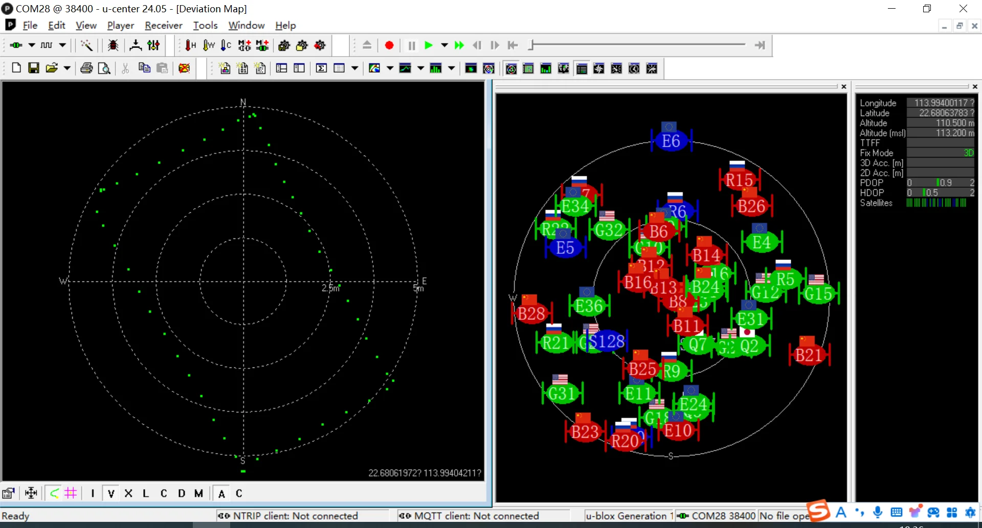
Official GNSS evaluation software for Windows: u-center
Performance
Free Shipping Over $199
- Standard Shipping: Standard Shipping (12–18 Business Days)
- Express Shipping: Expedited Shipping (5–9 Business Days)
- Free Shipping: Orders over $199 qualify automatically
- Tracking: Full tracking number provided for all orders
30-Day Return Policy
- Returns: 30-day hassle-free return window
- Condition: Items must be unused and in original packaging
- Refund: Full refund processed within 3-5 business days
Why Choose Us?
- Factory Direct: ISO/TS 16949 certified manufacturer
- Quality: 100% electrical continuity tested before shipment
- Experience: 15+ years in automotive connector industry
- Support: Professional technical support available

You may also like
Blog posts
Title
An excerpt of your blog post's content
Title
Date|Author
Subscribe to our emails
Be the first to know about new collections and special offers.